Current

5/25/2021

After being in the Abacos for almost three weeks we decided to move south, first to Eleuthera and then to the Exuma Islands.  These are known for being prime cruising grounds.  The map below gives an idea of the transit we will need to make, running from Great Abaco to Eleuthera.  This is a 60 mile transit across the NE Providence Channel, a stretch of open ocean with no bailout points until we get across. 

The weather forecast was for 3-5 foot seas with a long interval between the swells.  A subtropical storm, Ana, just dissipated northeast of Bermuda, and while this is almost 1700 miles away the swells reach this far.  They were worse yesterday, and so we waited for this day to do the crossing.  That was a good plan as the waves didn’t disappoint. 

As we crossed we ran into a section of the channel that had a significant current flowing to the northeast.  I had to turn the boat about 10 degrees to overcome the current effects.  We didn’t expect this at all, and since the wind was coming from the northeast we had a situation of wind against current.  For about 20 minutes we had 6-8 foot waves, a most unwelcome development.  After we passed through the current the waves returned to normal.  I don’t know why there was current in that location as the water was over 14,000 feet deep.

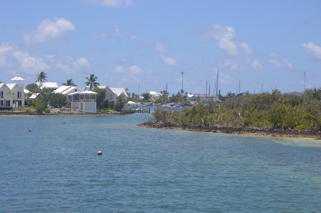
After completing the crossing we entered into the lee of Eleuthera near the town of Spanish Wells.  We initially planned to anchor in Royal Island Harbour but since it was still early we continued to an anchorage near the town of Current.  The anchorage is shown below.

This town is at the tip of this part of Eleuthera, and is separated from the next island by a narrow cut shown below.  We will go through this cut tomorrow to access the Great Bahamas Bank and islands further south.

A large portion of the bank drains it’s tidal waters through this cut, hence the name of the small town associated with it. Marilou is especially nervous about this, though I don’t anticipate a problem.

Linyard Cay

5/24/2021

Finally after almost two weeks of high winds we departed Hope Town harbor.  It was good to be in a safe spot during those winds, but we’re ready to be moving along again.  Today we are moving to an anchorage near the south end of the Sea of Abaco, and plan to anchor on the east side of a small island called Linyard Cay.

Along the way we passed a number of small islands, some of which formed barriers to the ocean, and others just were high points in the sea floor.  The photo below is one of the latter types of small islands, this one being Parrot Cay.  There are many such small islands in this area.

When we got near the ocean entrances we had a good view of the reef between some of the barrier islands.  A photo of this is shown below.  The waves are breaking on the reef, a sure sign a boat can’t go through that way.  In spite of there being many openings between the barrier islands, only a few are actually open enough for us to transit through the reef.  The second photo below is of the North Bar Channel, the spot where we plan to cross through the reef when we transit.

Just past the channel we arrived at Linyard Cay.  This is a remote island with a few houses on the north end, and no development on the south end of the island.  We anchored off a great beach, shown in the photos below.  Sinbad had lots of fun running around and digging in the sand.

While we were walking on the beach we found a conch shell (pronounced Konk).  This one had a very pink color.  The queen conch is a common shellfish in the Bahamas, and it is shown on their national seal.  We have eaten it repeatedly in restaurants, though we haven’t caught one ourselves. 

Tomorrow, if the weather is similar to predictions, we plan to cross the Northeast Providence Channel.  This is a 60 mile transit through the ocean, and we always take this seriously. 

Hope Town (Part 2)

Hope Town was first settled in 1785 by British Loyalists escaping the American Revolution.  One of the first arrivals was Wyannie Malone, a woman who was considered the mother of Hope Town.  Her house is still standing in the center of town (shown below) and is now a museum.  It isn’t open often because of the virus, and we didn’t get to visit it.  The house survived the hurricane with only minor damage, but the roof looks to be new.

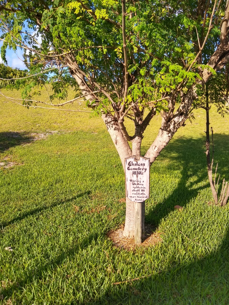
Hope Town has more than 200 years of history.  In the 1850’s there was a cholera epidemic and about 100 villagers were buried in a cemetery dedicated to them. 

The streets here were laid out and in regular use long before gas powered vehicles became available. Thus the streets are pretty narrow. They have been paved with thick concrete, but two vehicles can’t pass at the same time. Golf carts are common conveyances these days, and we tried unsuccessfully to rent one.

After our first three days were up we realized the winds would continue for a while yet.  So we extended for another week.  This didn’t leave us with many activities, but I can often find ways to stay busy.

Finally after 9 days the winds died down and we were ready to move on.  We plan to cross to another section of the Bahamas, the Exuma Islands.  More on that in a future post.

Hope Town (Part 1)

5/15-24/2021

After a couple days in the Tilloo Cay anchorage, and with the extended forecast for high winds, we decided to move to Hope Town.  This is a very old town for the Bahamas having first been established in 1785.  The harbor is small and well protected from waves and most winds.  The entrance to the harbor is shown below.  The entrance is fairly shallow, being around 6 feet at low tide, so we had to time our arrival based on the water level.

The harbor here is small, and filled with mooring balls for rent.  We rented one of these from the marina.  A couple views of the mooring field are below showing how close the moorings are to one another.  If one boat didn’t swing in the wind there is a good chance the next one could hit it, but thankfully this doesn’t happen often.  Anchoring isn’t allowed in this harbor because of the limited space.

In the background of the mooring field photo above one can see the Hope Town lighthouse.  This was built in the 1850’s to help ships avoid the reefs on the ocean side of the island.  It is a landmark that can be seen from many miles away.  It is still maintained using a kerosene lantern and hand cranked mechanism to rotate the Fresnel lenses that form the beams from the lighthouse.  There was a push several years ago to stop using this lighthouse, but locals still maintain it with the original equipment.  The lighthouse was damaged in the hurricane and isn’t open to visitors at the moment but it still operates each night.

Hope Town suffered extensive damage in Hurricane Dorian, but not so much as some other places.  A large proportion of the houses here are vacation rental properties, and these owners have enough money to repair the buildings and get back to hosting visitors.  Thus there is lots of construction in the town (referred to as the settlement) with workers coming by ferry every day from Marsh Harbour.

We did go for a walk to see the ocean beaches.  The winds hadn’t picked up yet in the first photo, but they had in the second one.  This is why we are sitting in the harbor waiting for calmer weather.

Tiloo Cay

5/13-14/2021

After departing the marina at Marsh Harbour we decided to anchor for a few days to wait for weather to cross the Northeast Providence Channel to Eleuthera and the Exumas.  The winds are predicted to be fairly strong from the north and east, and this spot should give good protection for most of those winds. 

Tiloo Cay, two photos of which are shown below, is largely a national park protecting the bird species in this area.  Fishing is allowed, and there are a few houses on the island.  At least one house is occupied as we heard a dog barking from a mile or more away at the south end of the island.

Some of the houses at the north end of the island are apparently not occupied.  We saw the unusual turret in the photo below, but it and the surrounding houses have not been repaired since the hurricane.  An adjacent island, Lubbers Quarters, is only about a mile away, and the houses there have been repaired already.

The seawater here is very clear, and we can easily see the vegetation, sand and rocks on the bottom.  We were starting to get low on water, so I put our watermaker in service.  This machine uses high pressure pumps to pressurize water to 800 psi, and then applies it to a permeable membrane.  Only fresh water can get through the membrane as the salt molecules are too large, and so we get fresh water from seawater.  I have a device that measures the total dissolved solids in the product water, and we are well within acceptable limits.  I also have some drinking water bacteria test kits, and these also pass without an issue.  So our fresh water supply is partially restored. 
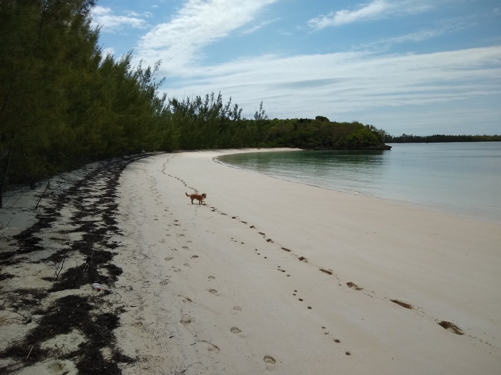
After two days at anchor the forecast called for high winds for an extended period, effectively making the crossing impossible for at least a week.  With that prediction, and with the poor beaches for Sinbad near our anchorage, we decided to move to Hope Town, a small town on a nearby island.  As we moved there we passed Tiloo Cut, an ocean entrance accessible to smaller boats.  Just inside the cut is a popular beach, and we saw an enterprising local businessperson had built a small takeaway restaurant and bar on a pontoon boat and had moved it to this location.  Pretty clever idea, and one that gave me a laugh.

Marsh Harbour

5/11-12/2021

After departing our anchorage at Great Guana Cay we moved to a marina in Marsh Harbour.  This town is the third largest in the Bahamas with about 6000 people.  It was especially hard hit in Hurricane Dorian with the harbor and much of the old downtown wrecked and still not rebuilt.  We are at a reconstructed marina/resort outside of the town proper.  As we approached the marina we saw a boatyard full of damaged and abandoned boats a little south of the town.  I suspect most of these are boats destroyed beyond repair, and which are in disposal by the insurance companies.

After the hurricane there was extensive looting in Marsh Harbour, much of it by illegal immigrant Haitians.  The Haitians were crowded into a section of the town call The Mud, and that was made untenable by flooding and hurricane damage.  They have since mostly moved out of the town to an area near Treasure Cay airport.  Native Bahamians don’t like to talk about it much, but they will occasionally express their displeasure with the problem and government inaction.  It is a problem similar to what we face in the US.

The harbor in town is still in a shambles.  There is extensive debris, and while some rebuilding has begun it is behind most of the other islands.  At one time there were some decent marinas and restaurants in the downtown area, but these are not back in service yet.  I didn’t take any photos since we went through town only briefly on our way to the supermarket and phone company store.

Maxwell’s Supermarket was surprisingly well stocked and was humming with activity.  There were lots of fresh foods and lots of shoppers.  On our way back to the marina the taxi driver told us the mail boat had come in that morning, so everyone was in the store taking advantage of the new shipment.  The mail boat comes about once a week from Nassau with supplies and fuel for the town and surrounding islands.

Our marina is hosting a small billfish tournament while we are here.  Billfish that are targeted include marlin, sailfish and other species such as dolphin.  The boats have to release the billfish, but they can keep the other species.  They video everything for fishing shows on television, and even have a helicopter flying around as part of the tournament.  One of the boats is pictured below heading out to fish in the morning.

Another boat that was participating in the tournament is also pictured below.  They were having some mechanical issue the day prior to the start of the tournament, and were late leaving the dock on the first day.  Later that morning I heard them calling a marina on Great Guana Cay trying to come in to get something fixed.  I imagine the pressure on the captain and crew was incredible.

After two days we will move out to anchor again.

Great Guana Cay (Part 2)

5/9-10/2021

The sunset this evening was quite spectacular with a small thunderstorm off in the distance.  An impressive display.

We went ashore again today (Monday) to walk around the island a little.  There is a well known bar here, Nippers, that we wanted to visit.  We found it as shown in the photo below, but it is still devastated from the hurricane.  I thought I had read it was partially reopened, but that wasn’t the case.

In spite of the hurricane damage, we enjoyed walking around the town here.  Lots of friendly people.

While we were in the anchorage a couple 100+ foot charter yachts anchored here also.  These are impressive operations.  They have a dedicated crew of 5-8 people including stewards, chefs and deck crew, host 8-10 passengers, and have a full array of toys from jet skis, fishing boats, and other things.  I looked up the yacht shown below, and it charters for $75,000 a week in the low season.  Looks nice, but that’s a lot of money.

Finally late in the day we went back to Grabbers bar since it was close to our anchorage.  There we met Mama, shown below.  She operates a small takeout restaurant (called takeaway in Bahamian dialect), and then works at Grabbers in the evenings.  She is really trying to make this work, and seemed to us that she is succeeding as best she can.

Tomorrow we will go to Marsh Harbour to provision and to get to a telephone company store.  We are using way more data than we expected, and I need to get another sim card for a second phone.

Great Guana Cay (Part 1)

5/9-10/2021

Since this is a long post I will break it into two sections.

This morning we made an early departure from the anchorage and continued south through the Sea of Abaco to Great Guana Cay.  This is another inhabited island with a well established settlement, a small store and regular ferry service to Marsh Harbour, the largest town in the region.

To get to Great Guana Cay we have to transit a passage around Whale Cay, out into the Atlantic Ocean, and then through a dredged ship channel back into the Sea of Abaco.  The winds were fairly strong, and this passage is known for generating large waves.  It didn’t disappoint this day as we briefly had 6-8 foot waves.  It was plenty uncomfortable.  A view of Whale Cay is shown below.  Photos of waves always seem to look smaller than they really appear when you are in them.

After passing through Whale Cay Passage we entered a dredged cruise ship channel.  This project was completed in the early 1990’s to enable cruise ships to call at a development on the north end of Great Guana Cay.  Unfortunately the dredged channel was still difficult to use, and it was abandoned after a few years.  Still, it makes a very good approach into the lee side of the island.  We anchored just off a small cove, and will stay here two nights.

In September, 2019 the Abacos were hit with by Hurricane Dorian, a Cat 5 storm with sustained winds above 180 MPH and storm surge greater than 20 feet in places.  Some people drowned when the surge rose, others had their houses severely damaged or destroyed, and in some cases the houses survived intact but were toppled onto their sides.  Recovery from an event like that is difficult especially when the local economy is dependent on tourism.  Of course, tourism dries up afterwards, and there isn’t money to clear away the debris or rebuild.  Still, the people here have a positive attitude and are pressing on as best they can.  Construction is ongoing everywhere.

After anchoring we launched the dinghy and went ashore.  There is a beach bar here called Grabbers, and since it was Sunday afternoon it was in full swing.  A photo of the bar is below.  We didn’t eat here, but the food looked good.

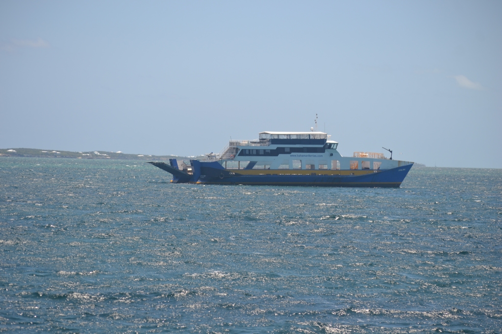
Most of these smaller islands are served by a variety of ferries, some originating in the regional capital of Marsh Harbour, and others from further away from places like Nassau.  A few of the boats and ships are shown below.  The first one is a passenger ferry from Marsh Harbour that runs every couple hours bringing workers to the island, and also taking islanders to the bigger town.  Most of the construction workers live in town and commute to their work this way.  In cases where larger equipment and supplies are needed there are transport ships with a ramp at the front as shown in the second photo.  These ships push their bow into a dock on the shore, lower the ship’s ramp, and then offload the equipment, lumber, and other bulky things needed on the island.  A third type of ferry is operated in between island groups, and is the primary transportation for people and vehicles.  This is shown in the third photo below.

Manjack Cay

5/8/21

We woke up this morning to a quiet anchorage at Powell Cay, and are planning a short transit to Manjack (pronounced MUNjack) Cay, so we don’t need to leave very early.  We decided to launch our new dinghy and go for a ride ashore.  Sinbad hasn’t had a chance to run and play for several days, so this was a good chance.

Our dinghy is stored on the upper deck.  To launch it we use a crane to lift it, then manually swing it out over the side of the big boat, and then lower it to the water.  It isn’t a difficult job, but it takes 15 minutes or so to get everything ready and go through the motions. 

After going ashore on Powell Cay we beached the dinghy as you can see in the background of the first photo below.  Sinbad had a good romp up and down the uninhabited beach, chasing birds and digging in the sand.  Several times he ran out into the water to chase a bird and surprised himself when it got to his chest quickly.  We haven’t taught him to swim or enjoy the water for fear he will like it too much.  After an hour on the beach he was ready to go back to the boat.

After getting Sinbad back aboard the big boat he was glassy-eyed the rest of the day, sleeping most of the time.  That was a fun excursion for him and us.

We then moved to a large anchorage at Manjack Cay.  This is an inhabited but privately owned island.  The inhabitants welcome visitors to walk the trails, but they ask that dogs are kept on a leash.  Many people have free ranging chickens on this island, as they do on most of the inhabited islands, and they don’t appreciate it if a dog kills their chicken.  We didn’t go ashore here.  A view of the anchorage is shown below.

After the sun set in the evening I was able to see the planet Mercury.  It isn’t often that it is visible, but it was clearly so this evening.  This is the first time I am certain I saw Mercury.

Powell Cay

5/7/21

We are finally getting into the area known as the Abacos.  These are a group of islands that are generally higher than those further west, and with more distinguishing features.  More islands here are inhabited, and importantly, we again have cell phone service.  That’s important because we get our weather forecasts via email, and need a cell phone connection to receive that.

There are small towns in this area including Fox Town and Cooper Town as well as some inhabited cays.  A couple of the islands have remote marinas focused on offshore fishing. 

We are anchored tonight at Powell Cay, one of the uninhabited islands.  This island has a higher bluff than some other islands, and has trails across to the Atlantic Ocean beach.  The photos below show the island’s beaches in our cove.

We were also treated to a gorgeous sunset tonight, and to a restful night’s sleep.  That was very welcome.